

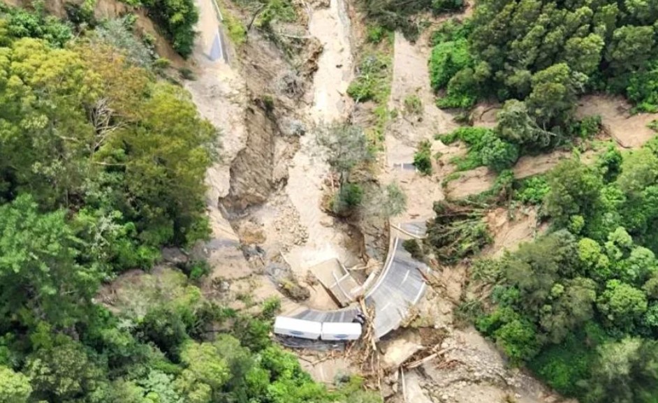
In New Zealand, landslides are becoming a more frequent consequence of extreme rainfall events. Recent examples include thousands of slips in Tairāwhiti in January, the loss of eight lives in the Bay of Plenty later that same month, and additional landslides that have damaged homes, forced evacuations, and blocked roads across the North Island in recent days.
Landslides are already among Aotearoa’s most costly and dangerous natural disasters, causing an estimated NZ$250–300 million in damage each year, and over the past 200 years they have caused more deaths than volcanic eruptions and earthquakes combined.
Why climate change is increasing landslide risk
New Zealand is naturally prone to landslides due to its steep terrain, weak sedimentary geology, and areas where vegetation has been removed. Heavy rainfall has long acted as a key trigger, as saturated soils lose stability and slopes fail suddenly.
Climate change is now intensifying this risk. Scientific projections show that extreme rainfall events are likely to become more intense as the atmosphere warms, particularly under higher emissions scenarios. Storms that were once rare are expected to occur more frequently, increasing pressure on already vulnerable slopes.
As a result, communities and infrastructure located below these slopes face greater exposure to landslide hazards.
Using new technology to map future risk
Understanding exactly where landslides are most likely to occur has traditionally been difficult due to the complexity of the processes involved. However, advances in data and computing are changing this.
Researchers are now using machine learning, a form of artificial intelligence, to analyse past landslide events alongside environmental conditions such as terrain, forest cover, and land use. This is made possible by large datasets derived from satellite imagery, which can now be used to map landslide damage quickly after storms and to assess terrain conditions across large regions.
Machine learning systems identify patterns between past landslides and environmental factors, enabling the creation of models that estimate where future rainfall-triggered landslides are most likely.
These models can then be combined with rainfall forecasts to generate real-time hazard maps, or used to assess how susceptibility changes under different climate scenarios.
Current research using these methods is examining how extreme rainfall interacts with New Zealand’s terrain today and how that relationship may evolve under climate change.
Early findings indicate that, under higher-emissions scenarios with increased rainfall intensity, the area of New Zealand vulnerable to rainfall-triggered landslides is likely to expand.
The relationship is also non-linear: many slopes are already close to failure thresholds, meaning even small increases in extreme rainfall can lead to disproportionately large increases in landslide-prone areas.
Forests can help reduce risk by stabilising soils and intercepting rainfall. However, under more severe future storm scenarios, even forested slopes are expected to become more vulnerable. This makes limiting further global warming a key factor in reducing long-term risk.
Implications for planning and resilience
These insights can support more informed land-use decisions, including identifying where forest cover should be increased and where high-risk development should be avoided.
They can also help authorities evaluate the long-term costs of maintaining infrastructure in hazardous areas and inform difficult decisions about whether some locations may be too risky for continued settlement.
New Zealand will remain a country prone to landslides. However, improved modelling and forecasting can help identify where risks are highest and how they are changing, enabling better decisions about where and how communities build and live.